Monday, 28 May 2012

"Norada"

Recently I spent the day with the Wherry Yacht Charter Charitable Trust in Wroxham.  I went there to film "Norada" being hauled onto the new slipway for some dry dock maintenance before she goes out on charter. The equipment to winch "Norada" onto the new slipway had been tested and trialed but this was the the first time it had been used for real.     The wherry yacht was winched out of the water just far enough to attach the A-frame and the air jacks.  Then slowly but surely "Norada" was inched majestically up the slipway - fascinating!

I have a limited knowledge of boats and their design so it was curiosity that drove me to research "Norada's" pedigree.

There is a theory that the elegant lines of the old trading wherries can be traced back to the Viking long ships.  True or not, there is no doubt that the graceful profile of a trading wherry is very pleasing to the eye.    When freight shifted from the river to the railway many trading wherries were converted to pleasure wherries.  Then, as tourism on the broads grew in popularity, purpose built pleasure wherries were turned out of the yards to meet the growing demand.   The ultimate development of the pleasure wherries led to the  emergence of the lighter and faster Wherry yachts.   "Luxury afloat" was unashamedly built into these hire craft and the Edwardians loved them.    

"Norada" is one of three wherry yachts currently operated by the WYCCT,  her sisters are "Olive" and "White Moth".   All three of these vessels were built by Ernest Collins of Wroxham.    The origin of these elegant craft is a fascinating story in its own right.

Wherry Yacht "White Moth"
(photograph courtesy of Katy Walters )

In late summer 1903, the beach yawl "New Skylark" was carrying thirteen passengers on a pleasure trip from the beach at Great Yarmouth.   About a mile out she collided with the F E Webb, a steamer out of London.  The "New Skylark" was practically cut in half and sank instantly with the loss of six souls.

Almost a week after the accident the wreckage of the "New Skylark" was recovered and towed into Yarmouth harbour.  Ernest Collins learned of the "New Skylark" and bought the wreck.   He redesigned her with cabin accommodation for ten adults and added a counter stern.  With a gaff and boom rig she was  re-launched as the wherry yacht  “White Heather”.   "White Heather" could be hired for around ten pounds per week including a skipper and an attendant, she continued working as a hire craft until 1932.

In 1909 Ernest Collins built "Olive" a dedicated wherry yacht naming the vessel after his youngest daughter.  The interior layout used in "White Heather" had been so successful it was replicated in "Olive".    "Olive" weighed in at twenty one tons with a draught of three feet six inches.   She could only squeeze under Potter Heigham bridge if tidal conditions were perfect, and passing under the old Ludham bridge was out of the question.

Next came "Norada" she was named after the nineteen metre class, racing yacht of the same era.  "Norada"  was launched in 1912, the same year as "Titanic".  However the the wherry yacht proved to be infinitely more durable than the ill fated liner.    "Norada" weighing just sixteen tons was shorter than "Olive" by three feet, and twenty one inches narrower in the beam.   She was designed specifically to pass under the "Old" Ludham bridge by virtue of a lower cabin than her sister "Olive"   "Norada's" reduced dimensions would also allow her to sail freely and unhindered through the locks on the Upper Bure and the Ant.  Ironically many of the locks and bridges were washed away in the great flood the same year she was launched. 


Racing Yachts circa 1900.
 
 "Norada" continued working as a hire craft until 1950 when necessary economies to the Collins hire fleet led to her being sold into private ownership, her new owner renamed her "Lady Edith".   Then in 1964 Barney Matthews, once a skipper for Ernest Collins, bought and restored the wherry yacht.  In her seventy-fifth year she was once again named  "Norada". 

2012 is "Norada's" centenary year - watch out for this spirit of the Edwardian age sailing on the Norfolk and Suffolk waterways this summer.  


If you would like to see a short video of "Norada" being "hauled out" click here.


Friday, 4 May 2012

Broads Under Threat

A great deal of time and money has been allocated to protecting the Broads and Broadland from flooding. One hundred and forty million pounds over twenty years to be precise. This is the Broadland flood Alleviation Project which has just reached its midway point.   Mile after mile of new dykes and banks now follow the course of the waterways - their presence may not please everyone but in the event of excessively heavy rainfall or tidal surges villages and waterside properties now have added protection.

Recently we had the cameras out at Happisburgh on the Norfolk coast - we went to see the properties about to be demolished in Beach road.   The erosion of the cliffs along this stretch of the coast has been going on for hundreds of years and the "Powers that be" plan to allow it to continue for at least the next one hundred.

What, you may ask, has this got to do with the Broads?
The flood protection plans currently being carried out in Broadland involve a large number of agencies, but none of them are responsible for Shoreline Management.

Property On The Edge

There is a Shoreline Management Plan and when it is boiled down it amounts to an orderly retreat from the sea.  As far  as the elements are concerned we are not going to fight them on the beaches.    The architects of the plan have forecast  the degree of cliff erosion  up to 2025, 2055, and 2105.  Nobody can be sure if the experts have got their forecasts right, we just have to trust in "The Great God Computer" and hope they have.   The slipway for the Happisburgh lifeboat slipped away sometime ago and the Lifeboat station itself has been demolished.   The lifeboat station was not due to fall into the sea for another twelve years.   Similarly, the catwalk leading to the beach stairway has been removed from the crumbling cliff, seemingly in the nick of time, its demise also appears to have crept well ahead of schedule.
 Old  Slipway
Remains Of The Beach Stairway

Talking to local people only provides anecdotal evidence but it does graphically illustrate what is happening to parts of the Norfolk coastline. Like the fellow who told me he remembered having tea in his friends garden when he was he was a teenager - he is now well into his sixties and the garden now lies more than a  hundred yards out to sea.
Timber Sea Defences
The Road To Nowhere.

The timber sea defences at Happisburgh were constructed in 1959 between Ostend and Cart Gap.  By 1989 the sea had rendered sections of them in-effective and since then the erosion of the cliffs at Happisburgh have accelerated at an alarming rate.    Local government has been fighting a losing battle to maintain the depleted sea defences with limited resources  and without any financial help from Central Government.
Local government agencies simply cannot raise the funds required to finance a civil engineering project of this magnitude, while Central government feel it is economically unsound to spend large sums of tax payers money to protect a few clifftop properties in a remote Norfolk village.   The rate of erosion is being monitored  in case the heart of the village becomes threatened.  When that time comes it may well be too late.


In the 1990's there was a feasibility study carried out to stabilise the cliffs and funds could have been made available for the scheme.  Unfortunately the various agencies procrastinated for such a long time that the window of opportunity to launch the scheme was lost along with more large areas of Happisburgh cliff.  The lack of decisive action for whatever reason means we no longer have a defence against the sea on this vulnerable stretch of coast.
Unstable Cliffs

Now for the scary part.  The moorings at Stalham are only five short miles from those disappearing cliffs at Happisburgh.  The landscape between the cliffs at Happisburgh and Stalham is flat rolling farmland.    Unless something is done, it is not a case of if the sea breaks through, but when.   In this event there will be absolutely nothing to stop the sea reaching the Broads.

It will not be in my lifetime but unless some action is taken it could happen in less than a hundred years.  To someone in their twenties that must seem an inconceivable time scale, although in reality it is barely a lifetime away.   This subject has been aired in many forums over a number of years.  To some enlightened individuals it is dismissed as scare-mongering. To other, equally, well informed people it is just a theory and it may never happen.   The view of this old "Norfolk boy" is somewhere between these two extremes.   Rising sea levels and increased rainfall in the 14th century were responsible for flooding the peat excavations and creating the Broads - what bitter irony it would be if it is the sea that destroys them.  


Bless This House.


Author's note.
There is no political agenda attached to the above article.  I only observe what heritage is preserved and that which is at risk.   "There is nothing more powerful than the power of nature".

Check out our new "Big Sky" website    http://bigskyuk.weebly.com/index.html

To see a clip of the demolition at Happisburgh click here


Sunday, 22 April 2012

The Norfolk Canals


As the county throws off its winter overcoat  the  rivers and woodlands already show signs of activity.
With this renewed activity comes a host of distractions.
Distractions are cuddly little creatures that amble innocently toward you like lost puppies and before you know it they are demanding a great deal of care and attention and in my case a large slice of filming-time. 

My main objective this year is to complete the film I started more than two years ago - if only I can resist those dreaded distractions that seem to be all around me.
The Bure at Oxnead

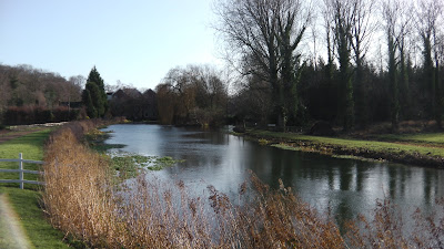
The two main distractions over the last twelve months have been the Aylsham Navigation and the North Walsham and Dilham canal.     I have spent a lot of time on both these projects and enjoyed every minute of it,  meeting many interesting and dedicated people in the process.

The Bure Navigation Conservation Trust is commemorating the great flood of 1912 this year.    I agreed to produce a film for them, I enjoyed myself so much I ended up making two.  The double DVD set was finished two weeks ago and profits from the sale of the DVDs  will raise funds for the Trust's conservation work.  The ultimate plan is to make the entire nine and a half miles of this beautiful stretch of canalised river accessible to the public.   All the parishes and villages along the upper Bure have worked together to make this possible.  It is extremely unlikely the Aylsham navigation will ever be accessible to larger craft but it is ideal for canoes and walkers.
The upper Bure is probably one of Norfolk's best kept secrets
The DVD's are on sale through the trust's website (£7.99.)  For more information on this project and the history of the navigation visit their website via the link.
http://aylsham-navigation.norfolkparishes.gov.uk/

Burgh Mill on the Aylsham Navigation.


The North Walsham and Dilham canal is a very ambitious project, the aim is to restore the canal to a navigable waterway.   It is a truly wonderful concept - the ultimate goal is to see boats using the canal once again after an absence of decades.   "Ella" was the last wherry to use the canal in 1934, after that the waterway became unloved and neglected for many years.

How things have changed.  Work parties of volunteers turn out at weekends in all weathers, wading knee deep in muddy mill pools, hacking through brambles and cleaning dykes and ditches.    Over the last twelve months progress on the canal has been absolutely astounding.  The work has progressed steadily and carefully with consideration for wildlife habitat and visual enhancement to the landscape.
For more information and news visit the EAWA website
 http://eawa.co.uk/walsham.html     - and look under work parties.

The Lock at Briggate Mill
You might like to see an  Egret making the most of a renovated section of the canal.
 http://youtu.be/3rrANidG0hQ         or click the  "My You Tube Link" on the right.

Sunday, 1 April 2012

There Are No Mountains In Norfolk

"If you think Norfolk is flat - get a bike!"
That was once the advice given to tourists visiting our beautiful county for the first time.

It is true, there are no mountains in Norfolk but we do have our own "Little Switzerland".
"Little Switzerland" are old chalk excavations near Coltishall that were abandoned many years ago.
The entrance to the chalk workings  at "Little Switzerland" were entered from the river Bure near Belaugh.  A series of channels were carved out  over several generations as great volumes of chalk were extracted from the  site.

Evening at Belaugh
Because the channels were only suitable for wherries of very shallow draught smaller lighters were built to ferry the chalk to the "Traders" waiting at the mouth of the excavations.

Chalk or marl was used mainly for improving agricultural land, it was also an important component in the production of bricks.  Marl was used primarily on the land to reduce acidity and improve the texture of the soil.  Wherries were able to provide a constant supply of  this valuable resource to local farms.  Marl mixed with farmyard manure improved the fertility of the land so much that farmers and land owners on the upper Bure claimed  "The carrots had doubled in size and the land had doubled in value".
On the Aylsham Navigation and the North Walsham and Dilham Canal chalk or marl was toll free which guaranteed work for the wherrymen supplying the lime kilns and farms along these waterways.

There are an abundance of chalk deposits close to the river Bure around Coltishall and Horstead.  Wherries would load the marl until the water lapped onto the plank ways, then loaded to the bins, the the great black sail would carry the marl through the network of rivers and broads sometimes up to fifty miles away.

Around 1810, a cart load of marl cost one shilling but it cost another three shillings and sixpence to transport it along the notorious Norfolk lanes and cart tracks.  It is no surprise to learn that marl became one of the most common cargoes carried by wherry.  The cavernous hold of the "traders" provided farmers with an economy of scale that horse drawn transport simply could not.
A Bridge at "Little Switzerland
Today the steep banks of "Little Switzerland" bear the scars from whence the chalk was extracted.  Willows and Elders have colonised the slopes and whole area has become a haven for wildlife.   The chalk workings were abandoned around 1870, a date that coincides with an expanding railway network.  Until then "Little Switzerland" would have been at the centre of a thriving industry employing many local men.   Some would have travelled across the river in small boats from Coltishall and Belaugh, others would have trudged along Granny Bard's Lane through the morning mist.  Probably carrying a bottle of cold tea and doorsteps of bread and cheese with an onion for added flavour.
Before the days of mechanisation the chalk would have been dug out with picks and shovels working along  terraced levels.  It would have been thirsty work in Summer and heavy work in Winter.
One Of  The Dried Out Channels


We recently attempted to canoe along the old chalk workings.  We left the Bure at Belaugh but it was only possible to travel a few yards along the channels which have dried out and become overgrown.  Our canoe soon came to grinding halt and any hope of retracing the route of the wherries was very quickly ruled out.
"Little Switzerland's" Concealed Entrance
I have been told that there was once a small tavern on the site where the labourers and wherrymen would congregate after work.  If this is true there is no evidence to suggest where the tavern was located, but we did see several old, broken bottles on the bank close to the entrance.

 The old chalk workings at "Little Switzerland" are private property and not open to the public.  However it is possible to see parts of the old channels and a bridge from a public right of way that runs alongside the estate.  I took a camera along there a few weeks ago to take a look.   The brambles put up a very determined defence and  in spite of several life threatening scratches I did manage to get a few  photographs.
Private Property Notification
The area is a great example of industrial archaeology and a glimpse into the past. If only those channels could be opened up and re-watered they would provide a magical boat trip through an enchanted forest.  But I guess that is never going to happen.

Authors Footnote.
There is very little information available relating to the chalk workings at "Little Switzerland".  Any additional information would be most welcome in order to satisfy my curiosity.

Jonno.


Wednesday, 7 March 2012

Vanishing Species

I started filming local crafts and traditions to capture them before they disappeared completely.
I hardly expected the losses to take effect quite so soon, before I had finished the film in fact.
On Saturday evening I dined with the eel-catcher who appears in the film.   During the course of the evening  the conversation inevitably turned to eels.  It seems that eel numbers have declined so much over recent years that they are in danger of becoming extinct.  I guess the majority of anglers will welcome this news.

Eels found in the East Anglian rivers (Anguilla anguilla) breed out in the Sargasso Sea, in an area between Bermuda and Puerto Rico.  The tiny eels are carried by the Gulf Stream until they reach the coasts of  Europe as two or three year old elvers.   They will spend the next twelve years living and growing in our rivers until they are mature enough to return to the Sargasso sea to breed.
The mature silver eels move down river on their way to the distant spawning grounds in late summer and autumn, mainly at night.
 Anguilla Anguilla
Two factors have conspired to threaten the species.  The first is a virus that effects the swim bladder of the eels.  The second is the export of the small elvers which are considered a delicacy and command a high price.   Both these factors result in fewer eels reaching maturity to return to the Sargasso to breed.  It is quite probable that children three generations on will never see a live eel and it is a racing certainty they will never see a live eel catcher.

During the early part of the nineteenth century there was an abundance of eels in the East Anglian waterways.  Some eel catchers made a living by trapping this remarkable fish while the marshman was probably satisfied with taking an eel or two for his family needs with an eel pick.
The Eel pick was a long handled tool with springy tines.   This method was used in shallow inland waters and salt water estuaries.  The eel catcher would look for bubbles from the eel’s fore and aft blow holes.  He would then strike with the pick, if done correctly the tool would be removed with an eel trapped between the tines.   Herons use their bills in the same way.

 Eel Pick
At the end of the nineteenth century catches were recorded by the stone.  In 1914 one eel catcher landed 129 stone of eels in a season.  
The biggest eel ever caught was in 1738 – it weighed sixty two pounds and measured twenty six inches around its girth.   

Ely in Cambridgeshire was once known as the Isle of Eels before steam power was used to drain the surrounding fens.  Such was the value of eels in the 11th century, that they were accepted as payment for taxes to the crown.

One hundred years ago many eel catchers lived aboard small boats out on the broads and estuaries; they used nets and traps to catch saleable volumes of eel.
Eel traps or hives, were made from willow with a conical funnel at the base and  a bung at the neck.  The funnel allowed the eel to squeeze into the trap but once inside it could not get out.  
Willow Eel Hive

The same principal is applied to fyke nets.   
The fyke net is a long net supported by metal hoops with three funnels or purses at the end, a long runner guides the eels into the purse and traps them in the same way as the old willow traps. 

My Eel-catcher friend assured me that eel numbers have declined by some eighty five per cent in the last few years - no species can survive those kind of losses.  Catches of eels are down year on year to a point when it is no longer viable to catch them for profit.
Long gone are the days when boxes of eels covered in wet sacks would be sent by rail to London to provide the capital with their diet of  "jellied eels"   Unless some form of conservation is rapidly deployed we will lose these remarkable creatures.  


Sadly it seems my trips out with the eel catcher on those long summer evenings are already a thing of the past.

Saturday, 11 February 2012

The Flood Of 1912.

One hundred years ago  forecasting the weather relied,  for the most part, on reading cloud formations  and watching the behaviour of wild creatures.  This method was not an exact science and the weather could, and did, spring some nasty surprises. This happened on August 26th 1912 when it rained for three days and three nights.  Rain of biblical proportions fell over Norfolk - in those three days bridges on the Aylsham Navigation were washed away and locks were destroyed by torrents of flood water.    In just a few hours the days of the wherries on the Upper Bure were gone forever, and with them one hundred and thirty years of  custom and tradition.

Oxnead Lock

It is ironic that in this centenary year of the great flood we are already facing water restrictions because of drought conditions persisting in East Anglia.   Knowing how "Mother Nature" has a way of balancing things when it is needed  - are we going to experience an extra wet spring or summer?
Could history be about  to repeat itself?

For the last ten months I have been working on a film for the Bure Navigation Conservation Trust.  The newly formed trust are commemorating the great flood of  1912 on August 26th this year.   It was only when I began to research the film that I discovered an absolute treasure trove of  local history.   Along this nine and a half miles of picturesque waterway between Horstead and Aylsham, are five historic watermills and a pair Tudor manor houses.

Burgh Mill

There are four churches on the  banks of the river - one of them, St Theobald, a sad old ruin that stands abandoned in an atmosphere of gloom and melancholy.  
Between Buxton and Oxnead the waterway flows silently past the forgotten resting places of Anna Sewell - author of "Black Beauty",  Walter Rye and Sir Clement Paston.

Sir Clement Paston

Running alongside parts of the navigation are the remains of the old M&GN railway line. A cast iron bridge, built in 1879, straddles the river at Buxton.   The line is now operated by the Bure Valley Railway.

Not only does the Upper Bure have a long and distinguished history,  it is thriving in these modern times.  Deer roam through it's woodland and Cattle graze in it's pastures.  Pike lie in deadly silence among it's reeds and Trout spawn in it's gravel shallows.  The Bure Navigation Trust is dedicated to protecting the river and making it more accessible to the public.  The old navigation is a unique place of  peace and tranquillity  - a legacy of the flood of 1912.


For more information about the Aylsham navigation and centenary events visit their website.  
http://aylsham-navigation.norfolkparishes.gov.uk/


Sunday, 22 January 2012

Review Of 2011.

Even though it has been a very mild winter the grey overcast skies and shorter daylight hours have curtailed my filming expeditions much more than I would have liked.   But every cloud has a silver lining and winter is a great time to edit and catalogue the film that has been shot throughout the previous twelve months.
Reviewing the material is like fast rewinding the year - remembering the places I have been and the people I have met during this years filming.   Here is a selection from 2011.    Enjoy!   


                       Vintage ploughing and farm machinery - a shot from "The Marsh"


                                                   Gentle Giants at the same event.


                             Oxnead mill pool from  "Aylsham Navigation" 

 
                                How Hill at sunset from  "My Norfolk Year"


                                Shooting a sequence for  "The Station"


 Hunstanton, the only place in Norfolk where the sun sets on the seaNot in any film - I just liked the shot.


Anna Sewell's birth place in Gt Yarmouth and the house in Norwich where she died shortly after writing  "Black Beauty".     Anna Sewell is remembered in "Aylsham Navigation"


Hunstanton church where a  customs officer and a dragoon are buried, killed by smugglers.
 Featured in  "The Marsh"


Between shots of  Reed cutters on the Waveney,  from "The Marsh".