Showing posts with label Aylsham-navigation. Show all posts

Tuesday, 4 September 2012

A Busy Ol' Summer

"Combines" drone across the East Anglian prairies as the long summer days diminish by degrees.  At sunrise Broadland is shrouded in morning mist and at sunset a chill pervades the evening air.   All these signs tell me   summer is rapidly coming to its end. 
 For me this time of year is always tempered with the slightest tinge of melancholy as the Swallows leave our shores and summer slowly fades away.    Very soon the rolling acres of golden stubble will be turned to brown by the plough and the entire county will melt from green and gold into an array of reds and browns.

Golden Stubble.

Looking back, summer has not been so bad in spite of the weather and quite productive even though good shooting days were few and far between.

By the beginning of  May we had finished a two part DVD set for the Aylsham Navigation centenary.  "A Wherry For Aylsham" and "The Aylsham Navigation".   The DVDs are currently on sale and raising urgently needed  funds for the fledgeling BNCT.  

On the North Walsham and Dilham canal work has been progressing at an astonishing pace.   The lock at Spa Common has been completely renovated and the lock gates have been built from scratch.  Both these items have been fascinating to watch and have produced some priceless archive footage.
Completed Lock at Spa Common
 At Ebridge the canal has been returned to its former glory and is teeming with wildlife.   I have never seen so many froglets at one time in my entire life.  The little critters were crawling over each other in their hundreds in the sheltered waters of the mill pool. This abundance of frogs will create a vital link in the food chain  - not the best news for frogs but it will please the Herons .   A Yellow Wagtail made himself at home on the dredger and a Kingfisher showed a great deal of interest as he sped up and down the renovated waterway, in a flash of iridescent blue.   It was at Ebridge that a (four spotted chaser) dragonfly kept me engrossed for almost two hours as it repeatedly skimmed the water and landed a few feet from the camera lens.  More great shots for the archive.

Further downstream  Briggate Mill and Honing lock are looking spruce and well cared for.   In fact the entire length of canal between Honing lock and Royston bridge has seen unbelievable progress which has been diligently recorded and safely stored.

A few miles away at WYCCT yard the wherry yacht "Olive" is undergoing some major surgery on the slipway.  My weekly visits have produced some interesting archive material.   Sister ship "Norada" was re-launched earlier this summer in time for her centenary year. Although the weather did it's best to spoil the day there was a gathering of wherries on Salhouse broad to welcome her back.
"Norada" On The Slipway

One of the highlights of the summer was the shoot on Wroxham broad,  I was invited as a guest of the Norfolk Wherry Trust.  The event was a celebration of the last Norfolk wherry to be built.  The wherry in question was the "Ella" now long gone - but not forgotten  -  sunk in Decoy broad some years ago when she reached the end of her useful life. Her skipper on that last journey, (Mr John Bircham) was among the guests. Five of the eight surviving wherries sailed into Wroxham broad in honour of "Ella"   Making a fantastic sight as they sailed in a loose formation around the broad.  It was a great filming opportunity which allowed me to capture some of my best wherry footage to date.
"Albion" Shooting Wroxham Bridge (Photo courtesey Chris Holloway)

Another highlight this summer was filming "Albion" passing under Wroxham bridge on her way to and from Coltishall where she was one of the star attractions of the BNCT centenary event.   In order to shoot the bridge it was necessary to flood the bilges to gain those precious inches of air draught that would allow her through.


 I am looking forward to Autumn and the softer light that comes with it and those sumptuous Autumn colours. 

If you would like to view clips of  the projects mentioned above click on the link below.

http://www.youtube.com/user/norriemk2?feature=mhee


Sunday, 22 April 2012

The Norfolk Canals


As the county throws off its winter overcoat  the  rivers and woodlands already show signs of activity.
With this renewed activity comes a host of distractions.
Distractions are cuddly little creatures that amble innocently toward you like lost puppies and before you know it they are demanding a great deal of care and attention and in my case a large slice of filming-time. 

My main objective this year is to complete the film I started more than two years ago - if only I can resist those dreaded distractions that seem to be all around me.
The Bure at Oxnead

The two main distractions over the last twelve months have been the Aylsham Navigation and the North Walsham and Dilham canal.     I have spent a lot of time on both these projects and enjoyed every minute of it,  meeting many interesting and dedicated people in the process.

The Bure Navigation Conservation Trust is commemorating the great flood of 1912 this year.    I agreed to produce a film for them, I enjoyed myself so much I ended up making two.  The double DVD set was finished two weeks ago and profits from the sale of the DVDs  will raise funds for the Trust's conservation work.  The ultimate plan is to make the entire nine and a half miles of this beautiful stretch of canalised river accessible to the public.   All the parishes and villages along the upper Bure have worked together to make this possible.  It is extremely unlikely the Aylsham navigation will ever be accessible to larger craft but it is ideal for canoes and walkers.
The upper Bure is probably one of Norfolk's best kept secrets
The DVD's are on sale through the trust's website (£7.99.)  For more information on this project and the history of the navigation visit their website via the link.
http://aylsham-navigation.norfolkparishes.gov.uk/

Burgh Mill on the Aylsham Navigation.


The North Walsham and Dilham canal is a very ambitious project, the aim is to restore the canal to a navigable waterway.   It is a truly wonderful concept - the ultimate goal is to see boats using the canal once again after an absence of decades.   "Ella" was the last wherry to use the canal in 1934, after that the waterway became unloved and neglected for many years.

How things have changed.  Work parties of volunteers turn out at weekends in all weathers, wading knee deep in muddy mill pools, hacking through brambles and cleaning dykes and ditches.    Over the last twelve months progress on the canal has been absolutely astounding.  The work has progressed steadily and carefully with consideration for wildlife habitat and visual enhancement to the landscape.
For more information and news visit the EAWA website
 http://eawa.co.uk/walsham.html     - and look under work parties.

The Lock at Briggate Mill
You might like to see an  Egret making the most of a renovated section of the canal.
 http://youtu.be/3rrANidG0hQ         or click the  "My You Tube Link" on the right.

Sunday, 1 April 2012

There Are No Mountains In Norfolk

"If you think Norfolk is flat - get a bike!"
That was once the advice given to tourists visiting our beautiful county for the first time.

It is true, there are no mountains in Norfolk but we do have our own "Little Switzerland".
"Little Switzerland" are old chalk excavations near Coltishall that were abandoned many years ago.
The entrance to the chalk workings  at "Little Switzerland" were entered from the river Bure near Belaugh.  A series of channels were carved out  over several generations as great volumes of chalk were extracted from the  site.

Evening at Belaugh
Because the channels were only suitable for wherries of very shallow draught smaller lighters were built to ferry the chalk to the "Traders" waiting at the mouth of the excavations.

Chalk or marl was used mainly for improving agricultural land, it was also an important component in the production of bricks.  Marl was used primarily on the land to reduce acidity and improve the texture of the soil.  Wherries were able to provide a constant supply of  this valuable resource to local farms.  Marl mixed with farmyard manure improved the fertility of the land so much that farmers and land owners on the upper Bure claimed  "The carrots had doubled in size and the land had doubled in value".
On the Aylsham Navigation and the North Walsham and Dilham Canal chalk or marl was toll free which guaranteed work for the wherrymen supplying the lime kilns and farms along these waterways.

There are an abundance of chalk deposits close to the river Bure around Coltishall and Horstead.  Wherries would load the marl until the water lapped onto the plank ways, then loaded to the bins, the the great black sail would carry the marl through the network of rivers and broads sometimes up to fifty miles away.

Around 1810, a cart load of marl cost one shilling but it cost another three shillings and sixpence to transport it along the notorious Norfolk lanes and cart tracks.  It is no surprise to learn that marl became one of the most common cargoes carried by wherry.  The cavernous hold of the "traders" provided farmers with an economy of scale that horse drawn transport simply could not.
A Bridge at "Little Switzerland
Today the steep banks of "Little Switzerland" bear the scars from whence the chalk was extracted.  Willows and Elders have colonised the slopes and whole area has become a haven for wildlife.   The chalk workings were abandoned around 1870, a date that coincides with an expanding railway network.  Until then "Little Switzerland" would have been at the centre of a thriving industry employing many local men.   Some would have travelled across the river in small boats from Coltishall and Belaugh, others would have trudged along Granny Bard's Lane through the morning mist.  Probably carrying a bottle of cold tea and doorsteps of bread and cheese with an onion for added flavour.
Before the days of mechanisation the chalk would have been dug out with picks and shovels working along  terraced levels.  It would have been thirsty work in Summer and heavy work in Winter.
One Of  The Dried Out Channels


We recently attempted to canoe along the old chalk workings.  We left the Bure at Belaugh but it was only possible to travel a few yards along the channels which have dried out and become overgrown.  Our canoe soon came to grinding halt and any hope of retracing the route of the wherries was very quickly ruled out.
"Little Switzerland's" Concealed Entrance
I have been told that there was once a small tavern on the site where the labourers and wherrymen would congregate after work.  If this is true there is no evidence to suggest where the tavern was located, but we did see several old, broken bottles on the bank close to the entrance.

 The old chalk workings at "Little Switzerland" are private property and not open to the public.  However it is possible to see parts of the old channels and a bridge from a public right of way that runs alongside the estate.  I took a camera along there a few weeks ago to take a look.   The brambles put up a very determined defence and  in spite of several life threatening scratches I did manage to get a few  photographs.
Private Property Notification
The area is a great example of industrial archaeology and a glimpse into the past. If only those channels could be opened up and re-watered they would provide a magical boat trip through an enchanted forest.  But I guess that is never going to happen.

Authors Footnote.
There is very little information available relating to the chalk workings at "Little Switzerland".  Any additional information would be most welcome in order to satisfy my curiosity.

Jonno.


Saturday, 11 February 2012

The Flood Of 1912.

One hundred years ago  forecasting the weather relied,  for the most part, on reading cloud formations  and watching the behaviour of wild creatures.  This method was not an exact science and the weather could, and did, spring some nasty surprises. This happened on August 26th 1912 when it rained for three days and three nights.  Rain of biblical proportions fell over Norfolk - in those three days bridges on the Aylsham Navigation were washed away and locks were destroyed by torrents of flood water.    In just a few hours the days of the wherries on the Upper Bure were gone forever, and with them one hundred and thirty years of  custom and tradition.

Oxnead Lock

It is ironic that in this centenary year of the great flood we are already facing water restrictions because of drought conditions persisting in East Anglia.   Knowing how "Mother Nature" has a way of balancing things when it is needed  - are we going to experience an extra wet spring or summer?
Could history be about  to repeat itself?

For the last ten months I have been working on a film for the Bure Navigation Conservation Trust.  The newly formed trust are commemorating the great flood of  1912 on August 26th this year.   It was only when I began to research the film that I discovered an absolute treasure trove of  local history.   Along this nine and a half miles of picturesque waterway between Horstead and Aylsham, are five historic watermills and a pair Tudor manor houses.

Burgh Mill

There are four churches on the  banks of the river - one of them, St Theobald, a sad old ruin that stands abandoned in an atmosphere of gloom and melancholy.  
Between Buxton and Oxnead the waterway flows silently past the forgotten resting places of Anna Sewell - author of "Black Beauty",  Walter Rye and Sir Clement Paston.

Sir Clement Paston

Running alongside parts of the navigation are the remains of the old M&GN railway line. A cast iron bridge, built in 1879, straddles the river at Buxton.   The line is now operated by the Bure Valley Railway.

Not only does the Upper Bure have a long and distinguished history,  it is thriving in these modern times.  Deer roam through it's woodland and Cattle graze in it's pastures.  Pike lie in deadly silence among it's reeds and Trout spawn in it's gravel shallows.  The Bure Navigation Trust is dedicated to protecting the river and making it more accessible to the public.  The old navigation is a unique place of  peace and tranquillity  - a legacy of the flood of 1912.


For more information about the Aylsham navigation and centenary events visit their website.  
http://aylsham-navigation.norfolkparishes.gov.uk/


Sunday, 22 January 2012

Review Of 2011.

Even though it has been a very mild winter the grey overcast skies and shorter daylight hours have curtailed my filming expeditions much more than I would have liked.   But every cloud has a silver lining and winter is a great time to edit and catalogue the film that has been shot throughout the previous twelve months.
Reviewing the material is like fast rewinding the year - remembering the places I have been and the people I have met during this years filming.   Here is a selection from 2011.    Enjoy!   


                       Vintage ploughing and farm machinery - a shot from "The Marsh"


                                                   Gentle Giants at the same event.


                             Oxnead mill pool from  "Aylsham Navigation" 

 
                                How Hill at sunset from  "My Norfolk Year"


                                Shooting a sequence for  "The Station"


 Hunstanton, the only place in Norfolk where the sun sets on the seaNot in any film - I just liked the shot.


Anna Sewell's birth place in Gt Yarmouth and the house in Norwich where she died shortly after writing  "Black Beauty".     Anna Sewell is remembered in "Aylsham Navigation"


Hunstanton church where a  customs officer and a dragoon are buried, killed by smugglers.
 Featured in  "The Marsh"


Between shots of  Reed cutters on the Waveney,  from "The Marsh".


Sunday, 10 July 2011

Buxton Mill to Aylsham Mill by Canoe.

Wednesday June 29th 2011.

It was barely nine - thirty in the morning and the sun was already uncomfortably hot.  Insects rose in coloured profusion  from the lush vegetation on the banks as our canoe cut its way through rafts of water lilies and floating grass.  Birdsong echoed around the reed beds and from trees overhanging the river.   This was not a remote mangrove swamp in some far off tropic - it was the river Bure running through Buxton Lamas in deepest Norfolk.

This was the second part of our  journey along the upper reaches of the Aylsham navigation, part one had ended at Buxton mill just shy of halfway.  The second half of the journey resumed at Buxton mill,  and barring obstacles on the navigation, we hoped  to make it all the way to the mill at Aylsham.  When planning the film, against all advice, I had decided to head upstream and finish at Aylsham as this seemed the most logical direction for the film to make any sense, after all it is called the "Aylsham" navigation.  Had we taken the easier option starting at Aylsham and heading downstream it was difficult to decide on a suitable finishing point?     It should be noted that the river is also known as the "Bure" navigation - but  for clarity of purpose I felt the film had to terminate at Aylsham.

Whatever name is preferred the second leg was five and half miles of paddling against the flow on a scorching hot mid-summers  day.   I was very fortunate to have Son Andrew and his mate Andy,  both experienced canoeists,  providing the motive power.  Just the same as the first trip I was up front with the camera, but this time I knew what to expect and was really looking forward to retracing the route of the old wherries

The Bure is surprisingly wide upstream from Buxton mill where, I guess, the water is held up by the restriction at the mill race.   "Bream Corner" so named by the wherrymen is a reasonably fast flowing reach making the the first part quite a tough stretch to paddle.  The water was crystal clear and  I could see fish darting beneath the canoe weaving in and out of the aptly named "Bur Reed"  (I know, it's spelt differently)
We glided past pretty riverside properties set in colourful gardens and dinghies and canoes tied up to lush green waterside lawns.    As we passed Lamas church, secreted amongst the trees, we saw several young jack Pike hiding in the reeds at the waters edge.  We left Buxton behind us and the river wound its way into the countryside through pastures fringed by reed beds and flag iris'.
For the entire five and a half miles we were accompanied by turquoise Banded Demoiselles (Damselflies).  They seemed to be everywhere, landing on the reeds and water lilies as we paddled by. 

Birds warbled all around us as the canoe pushed through the water  leaving Eddy's rippling in our wake.  Dragonflies hovered inches from the surface of the river while butterflies fluttered erratically above the river bank.  We had this little slice of English wilderness all to ourselves - priceless!

It took just under the hour to reach Oxnead Hall,  it's castellated tower looking slightly surreal and out of place against the other red brick buildings.   We passed under a  low bridge, tall trees lined the bank, behind them dense woodland shielded us from the sun until we reached Oxnead mill pool where we beached the canoe.  This was the first obstacle and possibly the most challenging.

It was easy enough getting the canoe out of the water but getting it over a stile and along a woodland path did increase the pulse rate.   Fifteen minutes later we were back on the river and paddling under the bridge at Oxnead heading toward Brampton and Burgh.  This bridge is where the wherrymen would moor their vessels and visit the Brampton "Maids Head" just a hundred yards from the bridge - sadly no longer a hostelry.   In the Brampton meadows a group of curious Hafflinger horses checked our progress as we paddled by.

Several swans had made themselves at home on the navigation, each with a clutch of young.   The Pen would hustle the brood into the bank while the Cob hissed and looked ready for a fight.   If the Cobs looked moody and menacing  we did the same.  This approach seemed to work as we achieved an honorable stand off  every time but if  I was really honest and it had come to a conflict my money would have been on the swans.
We had been on the water about two hours when we reached the deep water at Burgh lock.  The canoe was unloaded very carefully and and the old chap with the camera was assisted onto the bank.  We re-launched our little craft off the wall of the old lock, it was quite a drop.  I sat on the wall ready to lower myself gently into the canoe.  A large thistle biting my rear end did accelerate my embarkation much faster than I had intended.
Burgh church, partially hidden behind burgeoning willows drifted by on our right, there was no time for sight seeing,  "Cradle bridge" the wooden  foot bridge that links Burgh with Brampton was dead ahead forcing us to lie flat in order to pass safely beneath it.   Many years ago "Cradle bridge" was  much higher to allow the wherries to pass unhindered en route for Aylsham.

A little further upstream we approached Burgh bridge, once the site of wherry owner Isaac Helsdon's staithe. A large dog on the opposite bank barked at us, probably not used to people on his turf.  

After Burgh the river narrows markedly,  much of it choked by the encroachment of vegetation.  In some places  rafts of floating grasses reach out from the banks threatening to close the channel completely.   Three hours into our journey we decided to find a suitable place to pull in to stretch our legs and have a cup of coffee.  During this spot of recreation we spotted another three man canoe approaching from upstream, the first people we had set eyes on since we left Buxton. The only living things we had encountered up to then were several angry swans and an angry dog.   They pulled in and chatted with us for a while telling us there was a tree across the river about five hundred yards ahead.  They had only just managed to get under it.  Looking at our slightly larger canoe they thought we would find it difficult to get past. They added that  because of the dense undergrowth there was nowhere to leave he river to get around the tree.  This was not what we wanted to hear, providing we could keep to the correct channel we were less than a mile from Aylsham mill.   It would have  been extremely disappointing if we had to give up when we were this close.

After fifteen minutes we bade the other canoe farewell and headed off upstream.  We soon  found the fallen tree and it was big.  There was only one place we might get under it and that was close to the bank where the trunk formed a natural arch.   I was advised to lay flat.  Like a water-borne limbo dancer I leaned back as far as I could then collapsed onto the bottom of the canoe, wedged tightly and unable to move with the camera on my tummy the trunk of the tree passed an inch above my nose.   Willing hands grabbed branches and boughs and slowly passed the canoe under the tree.   Once clear of the obstruction Son Andrew helped me back into my seat and we set off for Aylsham.


Very soon we were paddling under the by-pass and we could see the the silos at "Dunkirk".   There was one last obstruction to overcome, a fast running weir.   Once again the canoe was unloaded and carried over land,  commando style.

Not surprisingly the engine room was beginning to feel the effects of what had been quite a long haul against the flow.   Soon after the weir we encountered three possible channels, hoping for the best we took the one in the centre which brought us up to the old wherry staithe which is now a very nice housing complex.   Around one last bend and we could see white water coursing through the mill race.  It was job done!

It is almost one hundred years since the navigation was ruined by the floods of 1912.   The locks and bridges were washed away and the days of the wherries on the Aylsham navigation were over.  We are not the first to make this journey and it is not a major achievement in itself, but by completing the route I felt we had relived a little bit of history - and recorded it.

If you would like to see two short videos of the canoe trip from Buxton mill to Oxnead and Oxnead to Aylsham mill the link is attached.
Or you can use the youtube link under my favourite links above right.
http://www.youtube.com/watch?v=ysyEZWQEMZ8&feature=plcp

Thankyou for looking.


Monday, 6 June 2011

Coltishall to Buxton by Canoe

Coltishall, Norfolk, May 1st 2011.

I guess the people who need to know are well aware that the navigation for larger craft on the river Bure ends at Coltishall - or to be precise - Horstead Mill.   Beyond this point flows a tranquil stretch of river largely undiscovered - The Aylsham navigation.  It was used by trading wherries until the great flood of 1912 when many of the bridges and locks were washed away.  In order to retrace the route of the old wherries all the way to Aylsham we needed to get a camera along these upper reaches of the Bure.  I reluctantly agreed that the most suitable craft for this task would be a canoe.    I have never made a secret of the fact  that I am not a natural sailor, nor have I spent a lot of time on the water.  Since I started making this film recording the history of  the Norfolk and Suffolk waterways I have found myself in a number of different craft.    But a canoe!  I must be partly Red Indian or completely mad.    

Initially the plan was to fix two canoes side by side to create a stable camera platform (and to make the old chap with the camera feel a lot safer) - the idea was like the "curates egg" - good in parts.   Unfortunately this meant we would have to get two canoes and the camera equipment in and out of the water to negotiate the  locks along the navigation.  My advisors (son Andrew and his mate) came up with a revised plan, all three of us would go in one canoe. Being the lightest, I would be in the middle to balance the canoe.  I pointed out this would mean I would be filming the back of someones head instead of the river.   So the plan was revised for the second time, I would go in the  front seat with the camera and equipment and the two heavyweights would sit amidships and astern.     Once the seating arrangements had been finally agreed the canoe was launched and I was nominated to load first.   The canoe looked very narrow, the river looked very wide and the water looked very wet.   The little craft rocked violently as I took my place in the front seat and stowed the camera equipment.   My knuckles turned white from gripping the sides of the canoe when both oarsmen took their turn to clamber aboard.   This was my first trip in a canoe and I promised myself, if I survived, it would be the last.
A few minutes later we had shoved off the Horstead slipway and were paddling towards Aylsham on the first leg of our assignment.   Deep down I knew I would eventually have to release my grip on the sides of the canoe and start shooting some film.

The first part of the navigation meanders through a canopy of trees that overhang the river - quite surreal - it is not difficult to imagine a heavily laden wherry nosing its way along this part of the river.

By the time we got to Coltishall bridge I was beginning to enjoy the trip.  I must have crossed Coltishall road bridge hundreds of times but this was the first time I had ever passed under it.  Bathed in sunlight the bridge looked a picture with its gentle arch mirrored in the water.  The bridge was rebuilt in 1913 after the great flood had washed away the original.

Paddle blades broke the surface of the river with a gentle splash.  The water rippled softly along the length of the canoe as we passed through Largate and on toward Mayton Bridge.    The lush green scenery glided past our little craft, a clear blue sky left its shimmering reflection in the river.  Perfect peace!  In no time at all I had become a committed fan of the canoe.  My fingers had returned to their normal pink colour and the camera was recording some mesmerising shots of the river.

As straight as an arrow the "New Cut" stretched out ahead of us,  on either side the trees had given way to verdant green pastures.  In the open water of the "New Cut" a stiff breeze met us head on as we approached Mayton bridge.


  On the the far side of the bridge the breeze freshened to a fairly brisk "Northerly"  making the water quite choppy.   Our little canoe glided serenely over the ripples through "Buxton Long" reach and past the romantically named "Goose Turd Hill".  One can only imagine why the old wherrymen gave it this name.

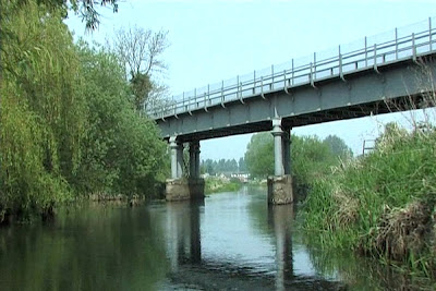
The  "Great Eastern" railway bridge lay ahead of us.  This three span girder bridge over the river Bure was built in in 1878 and carried trains on the "Bure Valley" line until it was closed to passenger traffic in 1952   freight trains continued to use the line until 1982.    Since 1990 the bridge has been used by the narrow gauge trains of the "Bure valley" railway running daily services between Coltishall and Aylsham throughout the summer.

As soon as we had cleared the railway bridge Buxton mill was in sight.  The white painted building standing out against the trees that border the mill race.   The approach to the mill was very shallow, we tried to pick out the channel until a grating and crunching beneath us brought the canoe to a standstill.  I guess it was the combined weight of the three of us that eventually grounded our gallant little canoe.  Donning my rubber boots I abandoned ship and carried the camera and equipment to the bank while the two lads recovered the canoe.

Part one complete I am really looking forward to part two.  Buxton to Aylsham - by canoe.
To see an edited video go to. 

http://www.youtube.com/watch?v=JiCMhQnsGuk